-
…and increased LIDAR coverage for Wales too
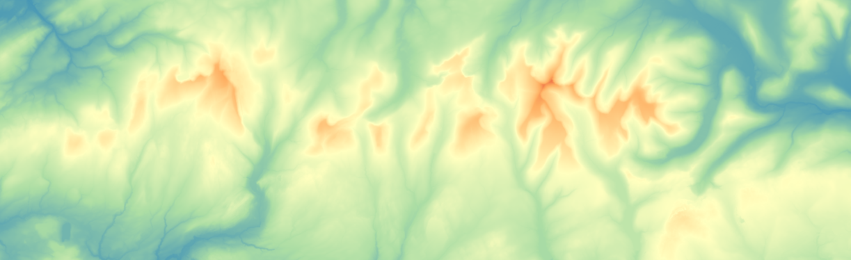
Hot on the heels of England’s LIDAR update, the Welsh Government have released their data from LIDAR surveys in 2020 – 2022. This dataset has a few gaps, in particular some coastal regions, but these were almost entirely covered in their older data. As a result, the combination of old and new LIDAR data gives…
-
Increased LIDAR coverage for England
The Environment Agency released their latest composite LIDAR-based digital terrain model for England last week. They state >95% coverage across England but it looks to be complete apart from a circle around Fylingdales in North Yorkshire. I’ve spent the last few days processing this and merging in with the Welsh LIDAR data to generate an…
-
Ready for the big time?
This site has been up and running for some time now, however most traffic has been going to Ollie O’Brien’s original site at https://oomap.co.uk A week or so ago, the servers used by Ollie’s site were upgraded, which broke the site. Therefore at least for now, all oomap requests are coming here – and it…
-
Out with the old, in with the new
The time has come to retire the 15 year old PC running my oomap instance and replace it with something a bit more modern, more powerful, more efficient and quite a bit smaller. Hopefully you’ll notice some performance improvements, particularly in serving up the contours in the web preview. This was a good opportunity to…
-
Smaller PDF files
When you download a PDF map, the mapping nicely fits inside the outer border. It’s not that simple however – the mapping data often extends beyond this border, but is visually clipped so that only the data inside the border is shown. Any external data is still there, but hidden – and takes up space…
-
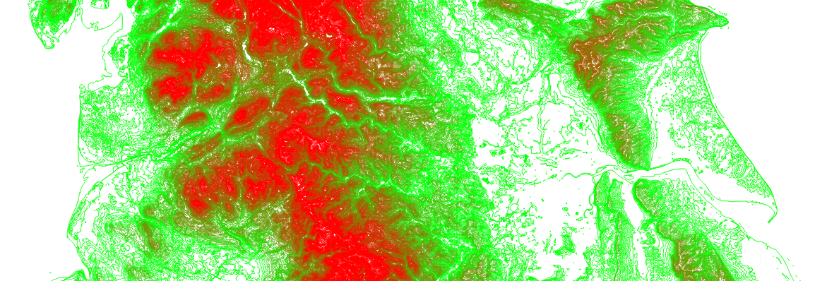
Contour Perfectionism
The current contour generation process queries a database for all the contours in a certain area. It then drops any very short contours as these are likely to be artefacts that aren’t useful, and draws tick marks to show slope direction. To make sure the ticks appear on shorter contours, the frequency of tick marks…
-
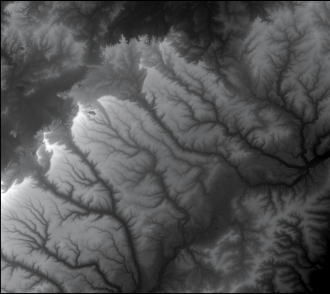
Scottish Contours (at last)
Although Scotland’s Environment Protection Agency makes available its LIDAR data (at https://remotesensingdata.gov.scot/data#/list), it isn’t easy to download the data in bulk, so I’ve not been able to download the full dataset and use to generate contours. The data is available as 5 separate datasets that overlap considerably, downloadable only as small areas (5km x 5km)…
-
Hertfordshire Updates
The LIDAR data at https://oomap.dna-software.co.uk/ currently covers around 85% of England, including most urban areas. Annoyingly there have been significant gaps in the coverage in my home county of Hertfordshire, which have meant that some of our Street-O events have been unable to use LIDAR contours. While the composite English LIDAR dataset is incomplete, individual…
-
Club logos

I’ve just reactivated a hidden option in oomap, which is to allow the map creator to tag the event with a club name, selected from a drop-down list. As well as tagging the event (for possible future use…), the renderer picks up the club name and adds the corresponding logo to the top-right corner of…