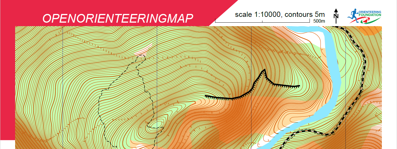
When you download a PDF map, the mapping nicely fits inside the outer border. It’s not that simple however – the mapping data often extends beyond this border, but is visually clipped so that only the data inside the border is shown. Any external data is still there, but hidden – and takes up space in the file. This is because the mapping database queries use a True North-aligned box. This is a particular problem where the map has been rotated, for example to correct for significant magnetic declination.
Here’s an example where the contour clipping has been removed:
A recent update has added better cropping of data in the mapping query so all the data (OSM mapping and contours) are now limited to the visible map area, giving smaller files.
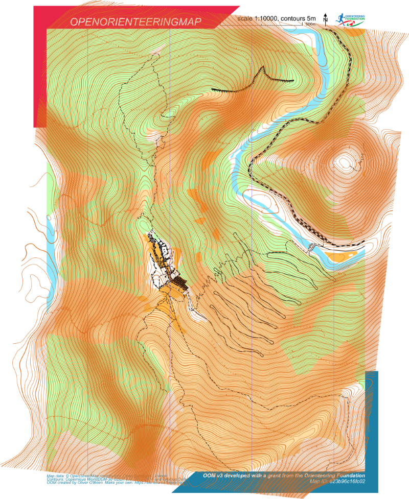
As a side-note, this is even more of a problem with UK contours in the original oomap – here contours extend way beyond the page boundaries:
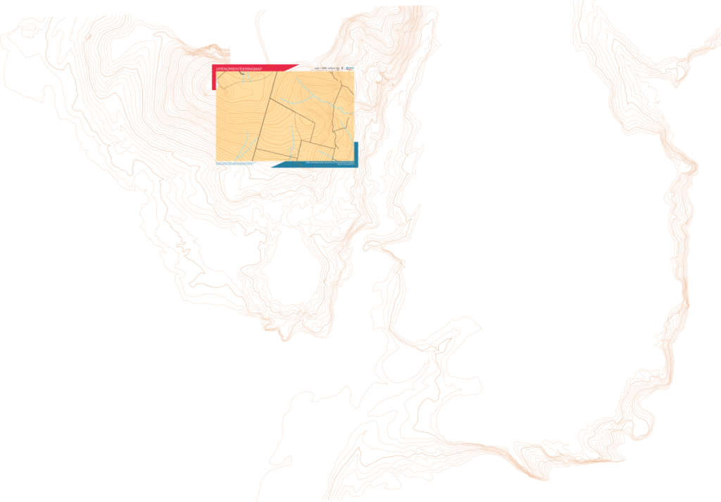
Improved data cropping reduces the file size in this example by over 80%.